As we prepare for World Fish Migration Day 2024, and its Free Flow theme, we at World Fish Migration Foundation have started ‘Free Flow Champions’, an initiative aimed to raise the profile of people championing freer flowing rivers. Our champion in September was Marcy Hamilton! Read Marcy’s story below.
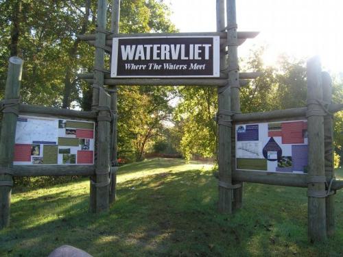
Marcy Hamilton is the Senior Planner and Deputy Executive Director at the Southwest Michigan Planning Commission. In 2011, Marcy and her team successfully removed the Watervliet Dams on the Paw Paw River in Michigan. The Watervliet Dams were built at the beginning of the 20th century to supply the Watervliet Paper Company Mill but they were left abandoned for more than 50 years.
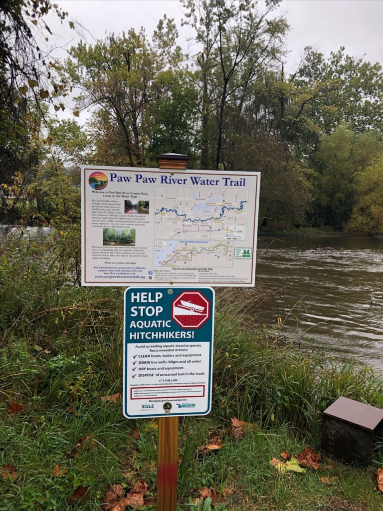
More than a decade after their removals, Marcy shared with us the various obstacles that they encountered along the way. The obstacles ranged from securing funding to overcoming public opposition. Additionally, Marcy highlighted that a canoe and kayak water trail has since been designated along the Paw Paw River. The water trail has become a hub of recreational activity, providing the local community with improved access to the river and numerous outdoor adventures.
What inspired the Watervliet Dam removal?
[Marcy] The Watervliet Dams are located in Watervliet Township, Berrien County, Michigan on the Paw Paw River. The dams were originally constructed prior to 1918 to divert flow to the former Watervliet Paper Company Mill that was located west of M-140.
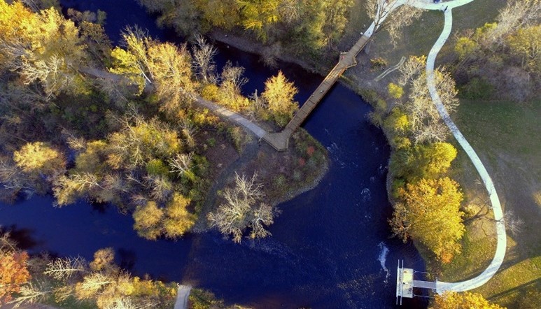
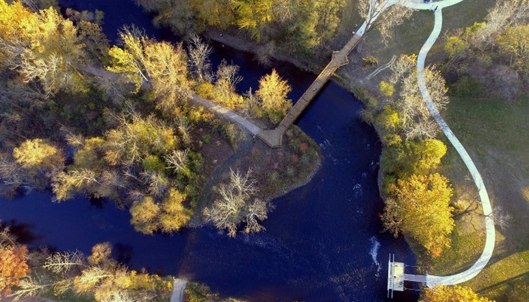
The two dams were constructed to raise the water level of the Paw Paw River and divert flow to the paper mill. An earthen dike connects the two dams together and isolates the mill race and the diversion canal from the historical channel of the Paw Paw River to the north. The Watervliet Paper Company closed, and the site was abandoned in 1968. The former paper mill site was owned by Berrien County Redevelopment Authority (BCRA). Now the land west of the Paw Paw River is owned by the City of Watervliet and the land east of the Paw Paw River is a Berrien County park. The BCRA had already removed the old paper mill and filled the diversion canal between the spillway dam and M-140. In addition, the metal structures that supported the piping, road, walkways, and guardrails were removed in the 1970’s due to corrosion. BCRA wanted to completely reclaim the site and return it to a safe and usable condition that is an asset to the community, and which no longer degrades the environment.
The Paw Paw River is an amazing river in southwest Michigan. With over 40 fish species, the Michigan Department of Natural Resources, Fisheries Division, and The Nature Conservancy consider the Paw Paw River one of the highest-quality freshwater systems in the Great Lakes Basin. The dams at Watervliet were the only barrier on the main stem from Benton Harbor to Paw Paw (over 60 miles). These dams were prioritized as critical for removal in a study of dams in the St. Joseph River Watershed which drains 15 counties in Michigan and Indiana.
Were there any challenges along the way and how were those overcome?
[Marcy] Funding is always challenging. The project was funded by the NOAA: National Oceanic and Atmospheric Administration – $922,759; Berrien County – $25,000; Michigan Department of Natural Resources $56,198; US Fish and Wildlife Service Fish Passage $100,000. There was some public opposition to the dam removals because some folks fished at the dam and were able to catch steelhead [an introduced species] and other migrating fish whose upstream movements were obstructed by the dams. In response, several public meetings were held to present the benefits of dam removal and overall benefits to fisheries.
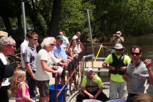
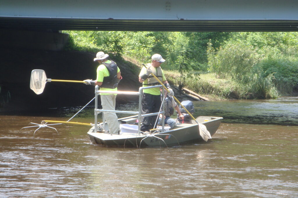
Also, there were folks in the community who had family that worked at the paper mills and the dams were the only physical remnant left from their existence and operation. The project team responded by working with the local history organization to conduct a tour of the site and to erect a sign that detailed the history of the paper mill and the importance it had in the community. Biological monitoring was difficult because the river is a medium-sized, non-wadable system with abundant large woody debris. This limited the biological monitoring methods and effectiveness.
How has the local community responded to the removal?
[Marcy] Since the removal of the dams, the communities along the Paw Paw River have organized with assistance from the Southwest Michigan Planning Commission and Two Rivers Coalition to develop a water trail for canoes and kayaks. The water trail is financially supported by the municipalities and the Pokagon Band of Potawatomi, who have land along the river. The water trail is a wonderful recreational resource that locals and visitors enjoy.
What fish species, or other species/ecosystems have benefited?
[Marcy] Providing that unrestricted fish passage has been restored, the removal of the Watervliet dams has significantly increased the length of stream accessible to native potadromous fish and an abundance of important spawning habitat. Target fish species including white sucker, longnose sucker, walleye, northern pike, and lake sturgeon are expected to benefit through increased reproduction and natural stock recruitment. Removing the Watervliet dams has restored unrestricted fish passage for native potadromous (e.g., walleye, white sucker, and longnose sucker) and resident fish species (e.g., redhorses, smallmouth bass, and walleye).
How many river kilometers/miles have been opened/reconnected thanks to the removal?
[Marcy] Removal of the Watervliet dams has provided access to 56 miles of the Paw Paw River mainstem (including the north and south branches) and 216 miles of tributaries, a total of 272 miles of stream. Prior to dam removal, only 101 river miles (19%) of the total 534 river miles were accessible. After dam removal, 373 river miles (70%) of the total 534 river miles are accessible. The remaining inaccessible river miles (161 miles, 30%) are located upstream of remaining fish migration barriers on the South Branch of the Paw Paw River (i.e., Maple Lake) and other minor tributaries of the Paw Paw River (primarily lake level control structures).
What is one thing you are most proud of about this removal?
[Marcy] I would say the opportunity to improve habitat and recreational use of the river. The communities have really rallied around the water trail.
What stands out to you/the team/community 10 years since the dam removal occurred?
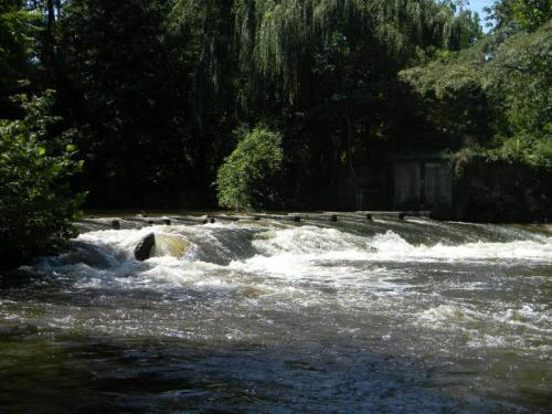
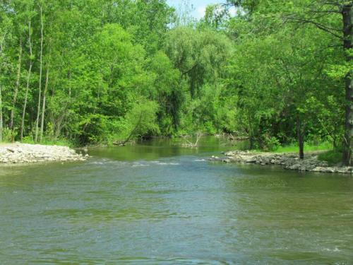
[Marcy] The river is absolutely beautiful through here and there are rapids that are fun to kayak/canoe through. The county has developed a wonderful park and kayak/canoe launch in this area that is well-used for hiking and enjoying the river.
(©Environmental Consulting & Technology, Inc.).
Read more Free Flow Champions and find inspiration for your World Fish Migration Day 2024 event.